Park nearby Dalhousie Park
Coronavirus disease (COVID-19) Situation
confirmed cases
4946090
deaths
59034
Canada
Park nearby Dalhousie Park
Dalhousie Park
Bell Street South, K1S 2A7, Ottawa, Ottawa Division, CA Kanada
contacts phone
:
+1
Latitude:
45.4021792
, Longitude:
-75.7029159
larger map & directions
read more
nearest Park
430 m
Glebe Memorial Park
Ottawa
Park
read more
434 m
Bytowne Urban Garden
Chamberlain Avenue, Ottawa
Park
read more
486 m
Tulip Festival Dow's Lake
Dow's Lake Road, Ottawa
Park
read more
504 m
McCann Park
80 Norman Street, Ottawa
Park
read more
563 m
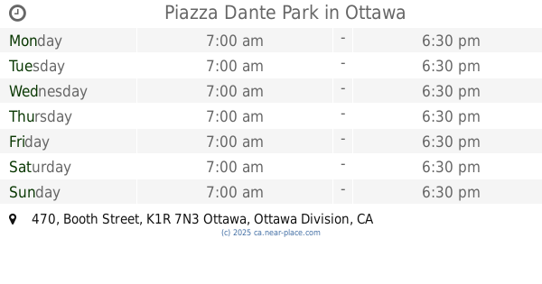
Piazza Dante Park
470 Booth Street, Ottawa
Park
read more
655 m
Commissioners Park
Queen Elizabeth Dr & Preston Street, Ottawa
Park
read more
655 m
Commissioners Park
Queen Elizabeth Drive & Preston Street, Ottawa
Park
read more
728 m
McNabb Park
Ottawa
Park
read more
734 m
Chamberlain Park
Ottawa
Park
read more
745 m
Ev Tremblay Park
108 Beech Street, Ottawa
Park
read more
805 m
Arlington Park
165 Arlington Avenue, Ottawa
Park
read more
894 m
Queen Juliana Park
870 Carling Avenue, Ottawa
Park
read more
901 m
Capital Park
Ottawa
Park
read more
924 m
Dow's Lake Peninsula
Ottawa
Park
read more
956 m
Central Park
19 Clemow Avenue, Ottawa
Park
read more
1.048 km
Plouffe Park
130 Preston Street, Ottawa
Park
read more
1.113 km
Dalhousie Community Centre Park
Ottawa
Park
read more
1.115 km
Brown's Inlet Park
Ottawa
Park
read more
1.2 km
Park Chaudiere
68 Elm Street, Ottawa
Park
read more
1.284 km
Primrose Park
179 Primrose Avenue, Ottawa
Park
read more
1.327 km
Fairmont Park
Ottawa
Park
read more
1.354 km
Trillium Pathway
204 Champagne - O-Train Corridor Multi-Use Pathway, Ottawa
Park
read more
1.496 km
Lionel Britton Park
19 Fifth Avenue, Ottawa
Park
read more
1.5 km
Nanny Goat Hill Community Garden
1 Laurier Avenue West, Ottawa
Park
read more
2.001 km
parking
ave w 5z9, 220 Laurier Avenue West, Ottawa
Park
read more
📑
all categories
Accounting
Administrative area level 1
Administrative area level 2
Airport
Amusement park
Aquarium
Art gallery
Atm
Bakery
Bank
Bar
Beauty salon
Bicycle store
Book store
Bowling alley
Bus station
Cafe
Campground
Car dealer
Car rental
Car repair
Car wash
Casino
Cemetery
Church
City hall
Clothing store
Colloquial area
Convenience store
Courthouse
Dentist
Department store
Doctor
Electrician
Electronics store
Embassy
Finance
Fire station
Florist
Food
Funeral home
Furniture store
Gas station
General contractor
Grocery or supermarket
Gym
Hair care
Hardware store
Health
Hindu Temple
Home goods store
Hospital
Insurance agency
Jewelry store
Laundry
Lawyer
Library
Light rail station
Liquor store
Local government office
Locality
Locksmith
Lodging
Meal delivery
Meal takeaway
Mosque
Movie rental
Movie theater
Moving company
Museum
Natural feature
Neighborhood
Night club
Painter
Park
Parking
Pet store
Pharmacy
Physiotherapist
Place of worship
Plumber
Point of interest
Police
Political
Post office
Premise
Real estate agency
Restaurant
Roofing contractor
Route
Rv park, camping
School
Shoe store
Shopping mall
Spa
Stadium
Storage
Store
Subpremise
Subway station
Supermarket
Synagogue
Taxi stand
Train station
Transit station
Travel agency
University
Veterinary care
Zoo
administrative area level 3
sublocality level 1
↑