Gas station nearby Petro-Canada
Canada
Gas station nearby Petro-Canada
Petro-Canada
6822 Highway 17, Coniston Canadá
contacts phone
:
+1
Latitude:
46.4956281
, Longitude:
-80.8667255
read more
nearest Gas station
5.244 km
Mr Gas
2002 Bancroft Drive, Sudbury
Gas station
read more
5.336 km
Pioneer Energy Gas Station
463 Falconbridge Road, Sudbury
Gas station
read more
5.338 km
Pioneer Energy
463 Falconbridge Road, Sudbury
Gas station
read more
6.274 km
Shell
1394 Kingsway, Sudbury
Gas station
read more
6.282 km
Mobil Gas Bar
1485 Lasalle, Sudbury
Gas station
read more
6.289 km
Mobil
1485 Lasalle Boulevard, Sudbury
Gas station
read more
6.363 km
Esso
3397 Falconbridge Rd, Garson
Gas station
read more
6.508 km
Canadian Tire Gas+ - Sudbury North
1070 Barry Downe Road, Sudbury
Gas station
read more
6.508 km
Canadian Tire Gas+
1070 Barry Downe Road, Sudbury
Gas station
read more
7.062 km
Pioneer Energy
1232 Lasalle Boulevard, Sudbury
Gas station
read more
7.231 km
Petro-Canada
1065 The Kingsway, Sudbury
Gas station
read more
7.368 km
PIONEER
1050 Kingsway Blvd, Sudbury
Gas station
read more
7.37 km
Pioneer Energy
1050 Kingsway, Sudbury
Gas station
read more
7.439 km
Esso
1003 Kingsway, Sudbury
Gas station
read more
9.221 km
Shell
476 Notre Dame Avenue, Sudbury
Gas station
read more
9.454 km
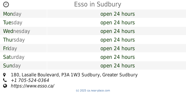
Esso
180 Lasalle Boulevard, Sudbury
Gas station
read more
10.377 km
Mobil
82 Lorne Street, Sudbury
Gas station
read more
10.439 km
Independent
82 Lorne Street, Sudbury
Gas station
read more
10.654 km
Shell
15 Centennial Drive, Sudbury
Gas station
read more
10.715 km
Petro-Canada
287 Lorne Street, Sudbury
Gas station
read more
11.073 km
Canadian Tire Gas+ - Sudbury South
2040 Algonquin Road #30, Sudbury
Gas station
read more
11.073 km
Canadian Tire Gas+
2040 Algonquin Road #30, Sudbury
Gas station
read more
11.554 km
Petro-Canada
1810 Regent Street, Sudbury
Gas station
read more
11.558 km
Shell
1329 Regent Street, Sudbury
Gas station
read more
12.733 km
Petro-Canada
1109 Lorne Street, Sudbury
Gas station
read more
📑
all categories
Accounting
Administrative area level 1
Administrative area level 2
Airport
Amusement park
Aquarium
Art gallery
Atm
Bakery
Bank
Bar
Beauty salon
Bicycle store
Book store
Bowling alley
Bus station
Cafe
Campground
Car dealer
Car rental
Car repair
Car wash
Casino
Cemetery
Church
City hall
Clothing store
Colloquial area
Convenience store
Courthouse
Dentist
Department store
Doctor
Electrician
Electronics store
Embassy
Finance
Fire station
Florist
Food
Funeral home
Furniture store
Gas station
General contractor
Grocery or supermarket
Gym
Hair care
Hardware store
Health
Hindu Temple
Home goods store
Hospital
Insurance agency
Jewelry store
Laundry
Lawyer
Library
Light rail station
Liquor store
Local government office
Locality
Locksmith
Lodging
Meal delivery
Meal takeaway
Mosque
Movie rental
Movie theater
Moving company
Museum
Natural feature
Neighborhood
Night club
Painter
Park
Parking
Pet store
Pharmacy
Physiotherapist
Place of worship
Plumber
Point of interest
Police
Political
Post office
Premise
Real estate agency
Restaurant
Roofing contractor
Route
Rv park, camping
School
Shoe store
Shopping mall
Spa
Stadium
Storage
Store
Subpremise
Subway station
Supermarket
Synagogue
Taxi stand
Train station
Transit station
Travel agency
University
Veterinary care
Zoo
administrative area level 3
sublocality level 1
↑